


Basics
- Class:
- Class I-III
- River Length
- 80 miles
- Time:
- 12 days
- Season:
- June to July
Description
The Canning River, located North of the Arctic Circle, drains the Philip Smith, Franklin, Shublik and Sadlerochit Mountains of the Brooks Range and is a fantastic high Arctic wilderness river float. The Canning River runs through the Arctic National Wildlife Refuge, flowing completely above tree-line on its way towards the Arctic Ocean.
A western tributary to the Canning River, the Marsh Fork of the Canning River is frequently used to access the main river. The Marsh Fork of the Canning River has intermediate level whitewater created by a constricted mountain river canyon. Rapids on the Marsh Fork of the Canning River feature standing waves, hydraulics, holes and exciting drops. Once the canyon eases, Marsh Fork flows into the Canning River and the valley opens into the wide Tundra covered Arctic Plain. The Canning River flows quietly from here, its powerful waters moving quickly towards the massive Canning River delta.
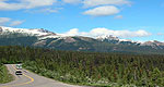
Canning River’s scenery is vast, featuring treeless Arctic Tundra and expansive views of the massive Brooks Range and the Arctic Plain. Wildlife viewing is excellent along the Canning River and this watershed serves as an important migratory route for the Porcupine Caribou Herd, numbering over 175,000 animals. In addition to Caribou other animals frequently sighted along the Canning River include Grizzly Bear, Wolf, Moose, Musk Oxen, and Dall Sheep.
Due to the remote nature of the Canning River, the put-in and take-out are both accessed via bush plane flights from Fairbanks through the small Gwich’in town of Arctic Village, located at the edge of the Arctic National Wildlife Refuge. Visitors to rivers in the high Arctic should be adventurous and open-minded. The Arctic region is a harsh environment and can take a bit of tolerance from her visitors. Weather in the Arctic can range from 80 degrees and sunny to 40 degrees and raining to 20 degrees and snowing, all within an hour.
During the summer months there is constant daylight in the Arctic region, a unique experience that should be factored into the trip planning. Gnats, mosquitoes and biting flies that see human visitors as a miraculous food source can also become an issue in the high Arctic. Proper measures should be taken by all visitors to the region to ensure their enjoyment of the experience. For those visitors willing to make the trip to the Arctic it is sure to be an amazing experience that will not soon be forgotten.