


Basics
- Class:
- Class I-II
- Suitability:
- Canoe
- River Length
- 90 miles
- Time:
- 10-14 days
- Season:
- June
Description
The Jago River is located North of the Arctic Circle in the upper Northeastern corner of Alaska. The Jago originates at the McCall Glacier on Mt. Isto (8,975 ft) in the impressive Romanzof Mountains, amongst the highest mountains of the Brooks Range. The Jago River drains seaward through the controversial 1002 section of the 19 million acre Arctic National Wildlife Refuge, which may be opened to future gas and oil exploration if legislation to protect it fails.
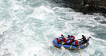
The Jago River, fed by the permanent snowfields and glaciers of the Romanzof Mountains, traverses treeless open tundra on its seaward journey. The Jago River is swift and rocky with numerous braided channels, allowing for smaller riffles to form and much excitement when channels change and the boat must be dragged to a larger channel. As a result, most trips down the Jago River involve small craft such as 4 man rafts, inflatable kayaks or canoes.
Scenery is spectacular along the Jago River, with open tundra rolling toward the bases of the towering Romanzof Mountains and the Arctic Ocean. As the Jago approaches its confluence with the Beaufort Sea in the Arctic Ocean, huge sand dunes form, adding another facet to the unique character of this landscape. Wildlife is seen frequently along the Jago River, including Bears, Wolves, Musk Oxen, Arctic Fox, Moose, and Falcons. Fishing opportunity is excellent on the Jago River, with strong populations of Arctic Grayling and Arctic Char.
River trips down the Jago River are most commonly combined with a multi-day backpack through the Romanzof Mountains, facilitating more exploration of this magnificent land. The Jago River is accessed via flight from Fairbanks to the small Gwich’in town of Arctic Village located at the edge of the Arctic National Wildlife Refuge and an additional bush-plane flight into the mountains for the start of the backpack to the river. At the takeout for the Jago River, where the river meets with the Beaufort Sea of the Arctic Ocean, a bush-plane transports visitors back to Arctic Village for additional homeward flights to Fairbanks.
Visitors to rivers in the high Arctic should be adventurous and open-minded. The Arctic region is a harsh environment and can take a bit of tolerance from her visitors. Weather in the Arctic can range from 80 degrees and sunny to 40 degrees and raining to 20 degrees and snowing, all within an hour. During the summer months there is constant daylight in the Arctic region, a unique experience that should be factored into the trip planning. Gnats, mosquitoes and biting flies that see human visitors as a miraculous food source can also become an issue in the high Arctic. Proper measures should be taken by all visitors to the region to ensure their enjoyment of the experience. For those visitors willing to make the trip to the Arctic it is sure to be an amazing experience that will never be forgotten.