


Basics
- Class:
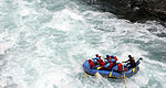
- Class II
- River Length
- 105 miles
- Time:
- 10 days
- Season:
- June
Description
The Killik River is located North of the Arctic Circle and originates in the Endicott Mountains of the western Brooks Range of Northwest Alaska. The Killik River is located within the 8.7 million acre Gates of the Arctic National Park and Preserve, an undeveloped wilderness National Park, with no roads, buildings, maintained trails or infrastructure. A multi-day adventure down the Killik River is perhaps one of the best ways to view and explore this little visited national treasure.
The Killik River winds through a glacial valley located above tree line and surrounded by 7,000 foot high peaks. Views of the Arctic landscape are sweeping from river level on the Killik River, especially broad due to the forestless nature of the land. The Killik features beginner level whitewater consisting of riffles, small ice shelf drops and shallow rocky sections mixed stretches of scenic water. Visitors to the Killik River can explore its river valley, the historic land of the Athabascan and Inuit people, and see remnants of ancient camps built eons ago by native nomadic tribes.
Summer is only a few months long in the Arctic region, and during this short season wildlife are plentiful, feeding and enjoying continuous daylight before winter once again sets in. The Killik River is on the migratory route for the Western Arctic Caribou Herd, numbering over 250,000 animals strong and visitors to the Killik will have the unique opportunity to see thousands of animals moving together to their summer calving grounds. In addition, Dall Sheep, Bear, Wolves, Lynx and Moose are commonly sighted along the river banks and visitors should be sure to bring their fishing pole as there is excellent fishing for Arctic Char, Northern Pike, Arctic Grayling, and the occasional Salmon.
The put in for the Killik River at a high alpine lake by Easter Creek and take out at the confluence with the Colville River are accessed via float-plane flight from Fairbanks.
Visitors to rivers in the high Arctic should be adventurous and open-minded. The Arctic region is a harsh environment and can require a bit of tolerance from her visitors. Weather in the Arctic can range from 80 degrees and sunny to 40 degrees and raining to 20 degrees and snowing, all within an hour. During the summer months there is constant daylight in the Arctic region, a unique experience that should be factored into the trip planning. Gnats, mosquitoes and biting flies that see human visitors as a miraculous food source can also become an issue in the high Arctic. Proper measures should be taken by all visitors to the region to ensure their enjoyment of the experience. For those visitors willing to make the trip to the Arctic it is sure to be an amazing experience that will never be forgotten.